What is the "tree withering" we often hear about at the end of autumn?
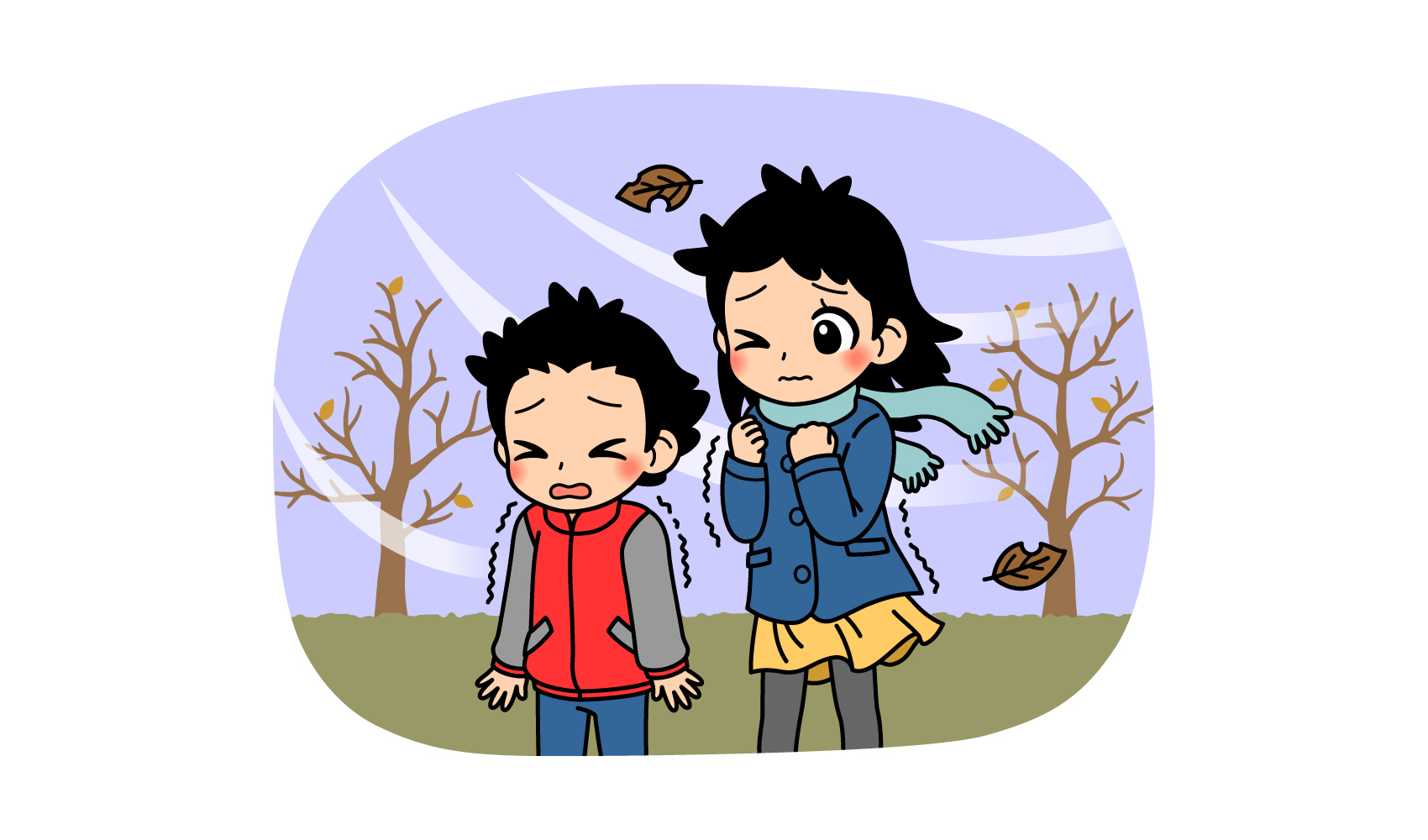
It is the season when the cold northerly winds come in. This time of year, you may hear the word "kinareashi," which refers to the cold northerly winds that are unique to this time of year.
Suddenly, here's a quiz.
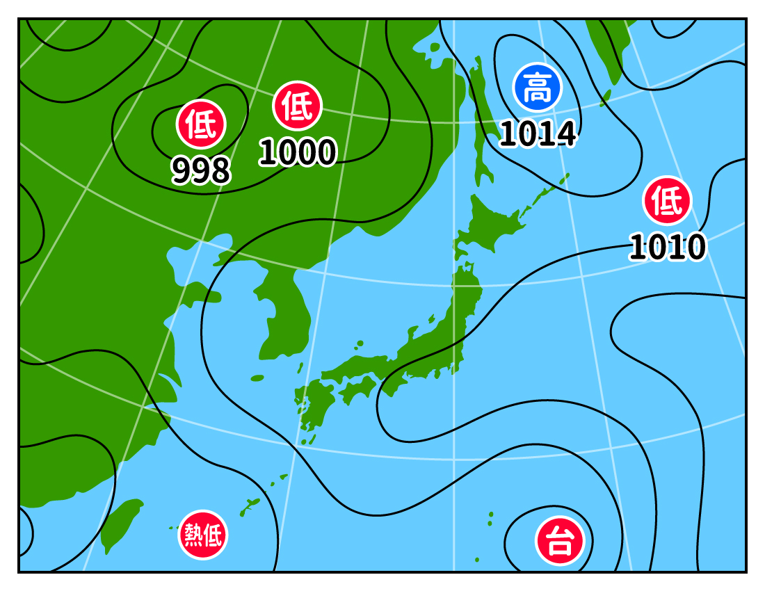
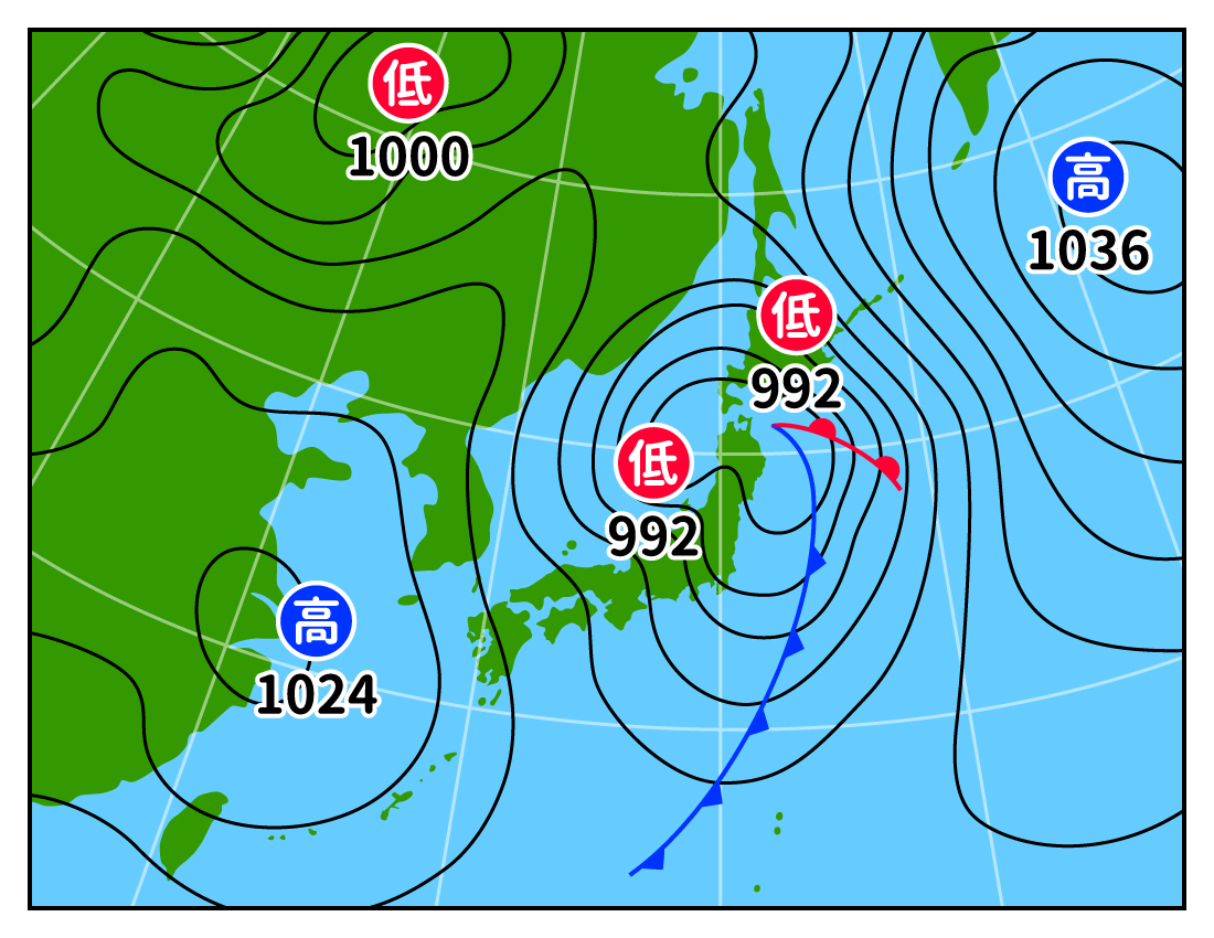
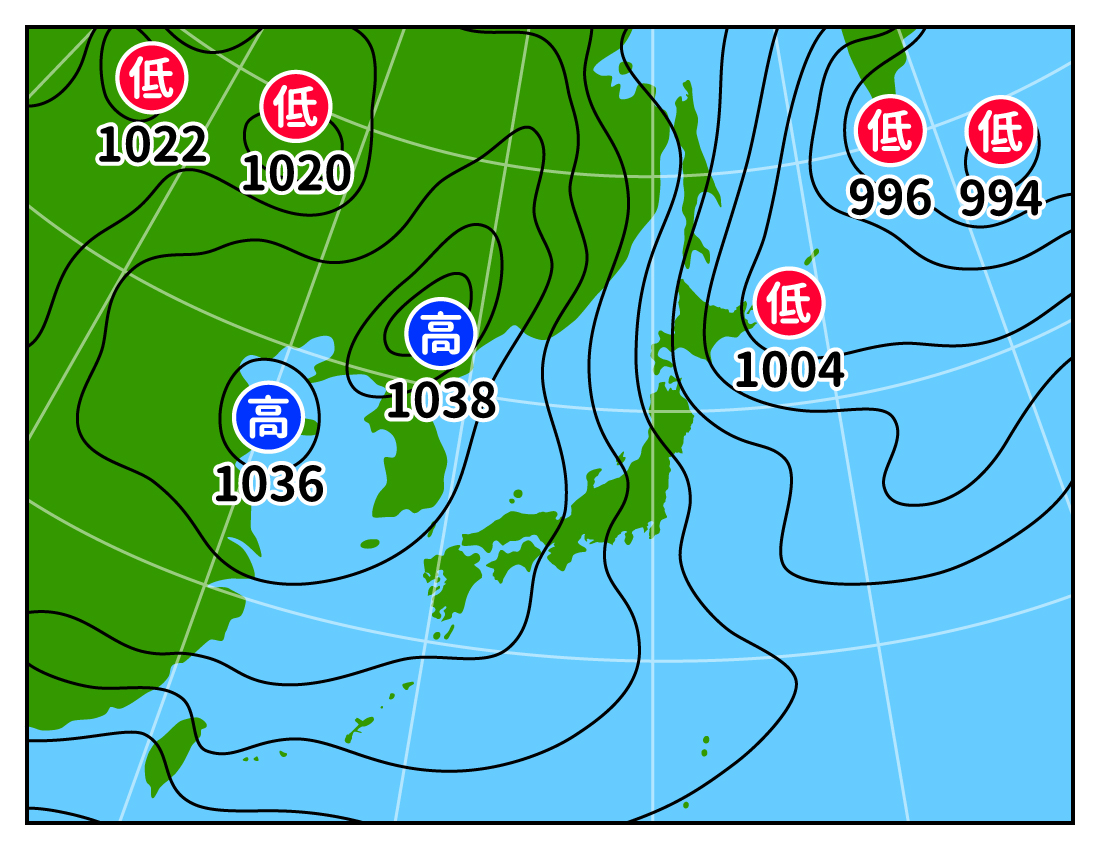
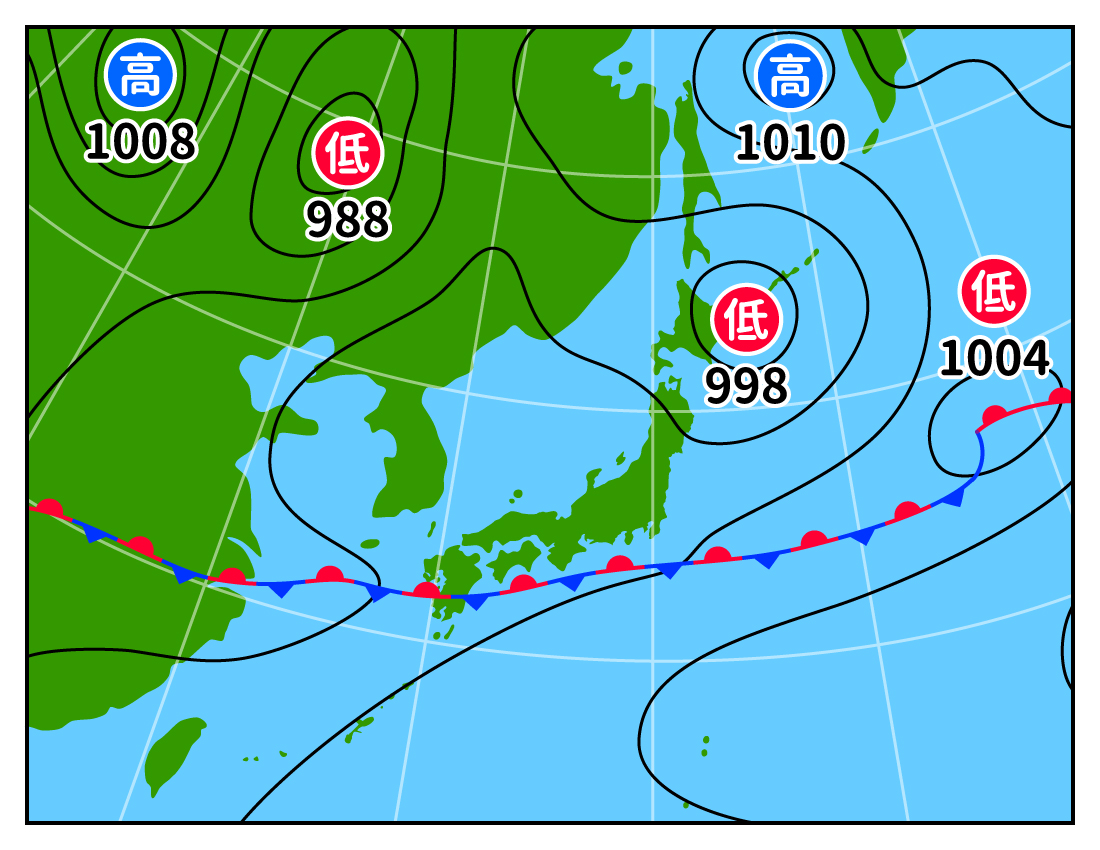
Which of the following four weather maps shows a wintry storm?
Source of weather map: Japan Meteorological Agency HP
The answer is C.
The weather map in C is called a "winter pressure pattern with high pressure in the west and low pressure in the east," and is often seen from late autumn to winter. The "isobaric line" connecting points of the same pressure is characterized by a vertical stripe pattern.
Incidentally, A is the weather map for midsummer when the Pacific High covers the Japanese archipelago, B is the weather map for spring and autumn when the migrating high and extratropical cyclone move from west to east, and D is the weather map for the rainy season when the rainy season front stagnates near the Japanese archipelago.
Kibarashi blows when there is a "high west and low east pressure pattern" in C. How does it work?
As autumn deepens and the days get shorter, it gets very cold near Siberia in Eurasia. This also cools the air above the cold ground. Since cold air is dense and heavy, a high-pressure system is formed. This high pressure is the "Siberian High.
On the other hand, the ocean, unlike land, does not heat up and cool down as easily. Even as autumn deepens, it does not cool as much as it does on land. Then, the air over the ocean becomes warmer than over land, and a low-pressure system is formed here.
Thus, an anticyclone forms over land in the west and a low pressure system forms over the sea in the east, resulting in a "high in the west and low in the east" pressure pattern.
From high pressure, wind is blowing outward. The destination of that wind is low pressure. In other words, when the pressure is high in the west and low in the east, the wind blows across the isobaric line from west to east. This cold and dry wind blowing from the Siberian High is the winter monsoon, which is called "kokareashi.
The first wintry storm of the year is called "KINARASHI No. 1. When the first "kinareashi No. 1" blows, the weather bureau announces that "kinareashi No. 1" has blown today. However, the announcement is made only in the Tokyo and Kinki regions, and each region has its own criteria for the announcement.
Tokyo Region's standard for tree death
| Period | From mid-October to the end of November |
|---|---|
| pressure pattern | Winter pressure pattern of high in the west and low in the east with monsoon |
| wind direction | Wind direction in Tokyo is from west-northwest to north |
| wind speed | Maximum wind speed in Tokyo is generally 8 m/s or higher |
Kinki Region's standard for tree death
| Period | Frostfall (around October 23) - Winter Solstice (around December 22) |
|---|---|
| pressure pattern | Winter pressure pattern of high in the west and low in the east |
| wind direction | northerly wind |
| wind speed | Maximum wind speed is more than 8 m/s |
The narrower the interval between the isobars on a weather map, the stronger the wind and the colder it will be. If a winter pressure pattern of high in the west and low in the east appears in the morning weather forecast, it is recommended to wear a jacket that will protect you from the wind on that day.
Text/Akiko Imai