What is the "first day of spring" that heralds the arrival of spring? Is there a difference between a refreshing image and a difference?
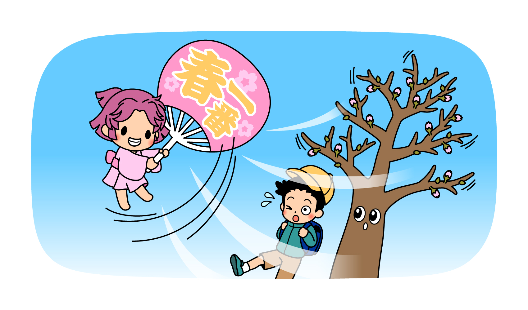
In February and March, when the season changes from winter to spring, the Japan Meteorological Agency sometimes announces that "the first day of spring has arrived in the 00 region. Although the word "first day of spring" may give a refreshing image, a closer look at the details reveals a surprising gap. In this article, we will introduce the mechanism by which the first day of spring occurs and its true nature.
Strong southerly winds blowing into a low-pressure system is the true nature of the first day of spring
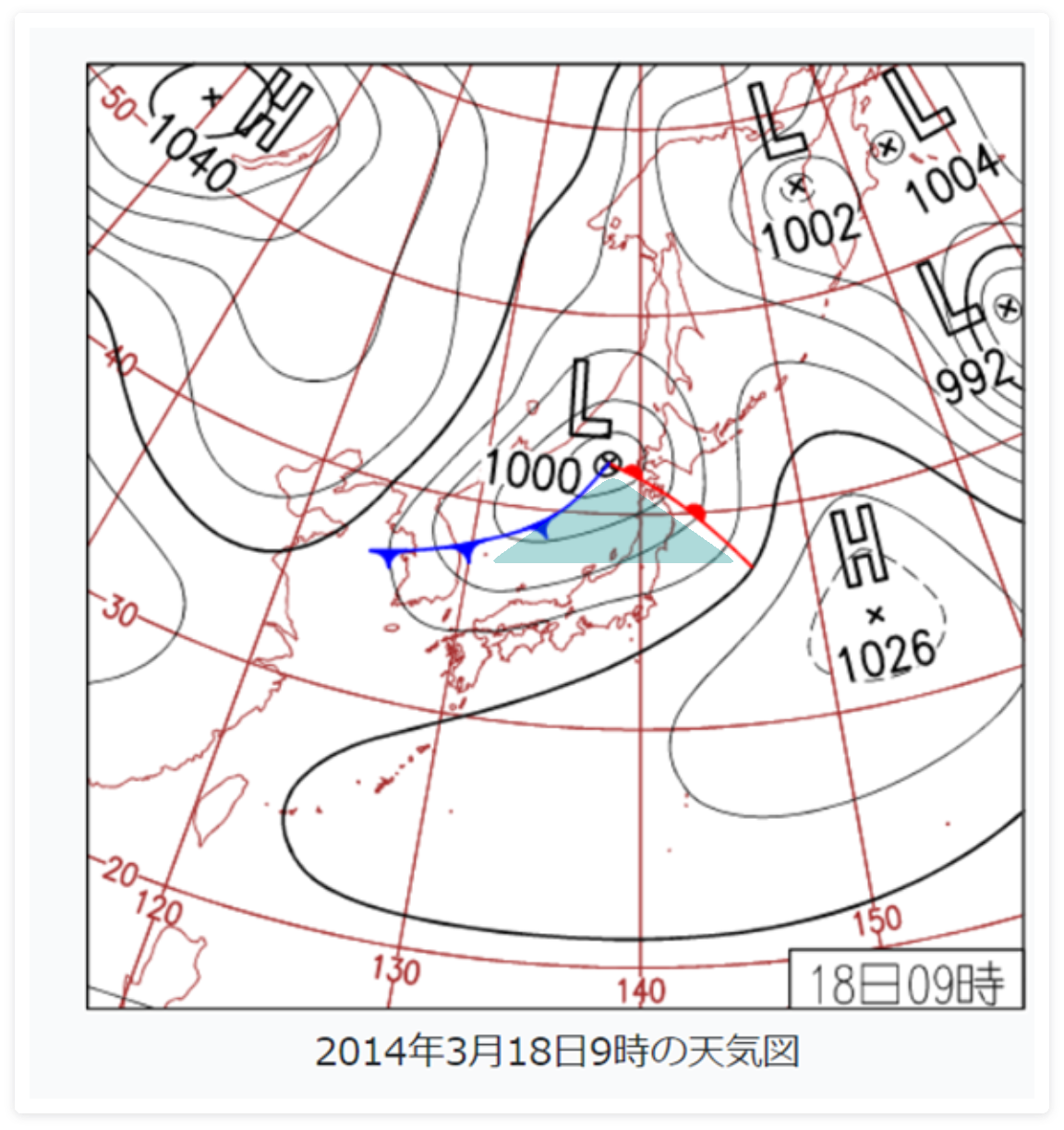
The first wind of spring is a strong southerly wind (wind blowing from a scattered direction in the range from southeast to southwest, mainly from the south) that blows first between the first day of spring (around February 4) and the first day of spring (March 20 or 21). This southerly wind blows from winter to spring when a low pressure system passes over the Japanese archipelago. When a low pressure system is accompanied by a warm front and a cold front, southerly winds blow in the triangular-shaped area surrounded by the warm front and the cold front (the green area in the following figure). This is the true nature of the first day of spring. Since the first day of spring is a southerly wind, the temperature rises dramatically when it blows.
The first day of spring is from Risshun to the vernal equinox, and although there is a common standard that the wind direction is toward the south, the standard for temperature and wind speed announced by the weather bureau differs slightly from region to region. In Hokkaido, Tohoku, and Okinawa, even if a low-pressure system passes through, spring-like weather does not necessarily occur, so the first day of spring is not announced.
The detailed criteria for the first day of spring for each region are as follows. The actual announcement of the first day of spring is made based on a comprehensive judgment within the meteorological observatory along with these criteria. If the winds that meet the criteria do not blow between the first day of spring and the vernal equinox, the first day of spring will be "no announcement. Since there are some years when the first day of spring is not announced, the normal value of the day when the first day of spring blows is not calculated. Also, if a wind like the first of spring blows for the second or third time, it is not numbered as "the second of spring" or "the third of spring" like a typhoon. Only the "first day of spring" is announced.
Criteria for each region for the first day of spring
Southern Kyushu, Amami
| wind speed | More than 8 m/sec. |
|---|---|
| atmospheric temperature | Ascending. |
| Atmospheric conditions | Affected by low pressure |
Northern Kyushu (including Yamaguchi Prefecture)
| wind speed | More than 7 m/sec. |
|---|---|
| atmospheric temperature | Rise from the previous day |
| Atmospheric conditions | nashi (Pyrus pyrifolia, esp. var. culta) |
Shikoku (smallest of the four main islands of Japan)
| wind speed | Slightly strong winds (maximum wind speeds are generally 10 m/s or higher) |
|---|---|
| atmospheric temperature | Maximum temperature increased from the previous day |
| Atmospheric conditions | Low pressure develops near the Sea of Japan |
Chugoku region
| wind speed | Strong winds blow |
|---|---|
| atmospheric temperature | High (maximum temperatures of at least 3°F (10°C) higher than the previous day) |
| Atmospheric conditions | Low pressure develops in the Sea of Japan |
Kinki (region around Osaka, Kyoto, Nara)
| wind speed | More than 8 m/sec. |
|---|---|
| atmospheric temperature | Maximum temperature above normal or above the previous day's value |
| Atmospheric conditions | Low pressure in the Sea of Japan |
East Sea (controversial name for the Sea of Japan proposed by Korea)
| wind speed | More than 8 m/sec. |
|---|---|
| atmospheric temperature | Maximum temperatures above normal at any of the local weather stations in the Tokai region (Nagoya, Gifu, Tsu, Shizuoka) |
| Atmospheric conditions | Consideration of atmospheric pressure placement, etc. |
region west of Tokyo on Japan Sea side of Japan
| wind speed | 10 m/s or more at any of the local weather stations in Niigata, Toyama, Kanazawa, or Fukui, and 6 m/s or more at any of the local weather stations in Niigata, Toyama, Kanazawa, or Fukui other than the local weather station that recorded 10 m/s or more (e.g., the day when 10 m/s or more was observed at the Niigata local weather station and 6 m/s or more at the Toyama local weather station) |
|---|---|
| atmospheric temperature | Maximum temperature is higher or almost the same as the previous day |
| Atmospheric conditions | Low pressure develops over the Sea of Japan |
Kantou (eastern half of Japan, including Tokyo)
| wind speed | More than 8 m/sec. |
|---|---|
| atmospheric temperature | Ascending. |
| Atmospheric conditions | Low pressure in the Sea of Japan |
Actually frightening! Strength of the first day of spring
Why is such a southerly wind called "the first gust of spring"? In fact, there was an unfortunate accident that led to the creation of the term: on the 13th day of the second lunar month in 1859, all 53 fishermen who were out fishing in Gonoura, Iki City, Nagasaki Prefecture, were struck by a strong gust of wind and lost their lives. In 1987, the "Tower of Spring First" was built in the park where the cenotaph for this accident is located.
Most of the criteria for the wind speed of the first spring storm is more than 8 meters per second. This 8 meters per second or more is equivalent to a speed of 28.8 kilometers per hour. In other words, it is about the speed of a moped. On days when the first winds of spring blow, the wind can blow away laundry, and when sand is blown up, it is hard to walk because the sand gets in your eyes. Strong winds can also cause bicycles and motorcycles to fall over and objects to fly off. In snowy areas, avalanches and flooding due to melting snow can occur as temperatures rise. It is important to remember that the word "spring" gives a mild impression, but it is a much more ferocious phenomenon than one might imagine.
After the first day of spring, the wind direction will shift to the north and the temperature will drop. As the low-pressure system passes, first the southerly winds blow and the temperature rises sharply, and then the northerly winds blow and the temperature drops. This is a repetition of the "three steps forward, two steps back" method, and the gradual rise in temperature is a characteristic of this season.
Text/Akiko Imai